|
|
|||||||
|
4
Added COGO (Coordinate Geometry) functions.
4
Ability to
create CONTOUR maps for a specific
topic or create contour lines for a specific area.
4
Full customization of PC-GPS tool bars and menu
items.
4
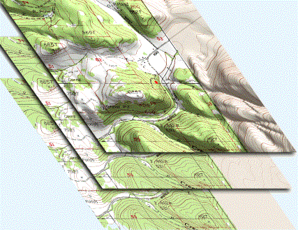
Support for DEM (Digital Elevation Model) data to create
contour lines, 3D shaded relief overlays. Drape topo maps on
top for shaded relief on your topo map.
4
Added function
for creating features from Deed Call text as well as creating Deed Call text from existing features.
4
Improvements
made to the Create Cruising Grid function.
4
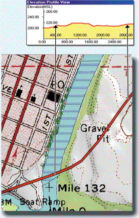
Elevation
Profiling available to see changes in elevation over a user-specified
transect.
4
GeoJPEG image
support.
4
Now you can
display Bearing or Azimuth in the
status bar when digitizing.
4
Added a Load Background Map capability to load other
map files in the background to be used as a guide for digitizing or
reference.
|
|||||||
|
||||||||
Additional Highlights:
|
|
|||||||
4
Automatic BaseMap loading w/ preset colors, patterns and labels
4
Intelligent labeling for street names
4
Copy BaseMap
elements into your map as features
4
Built-in DEM support for contour
lines and shaded relief on
BaseMaps.
4
Plot your maps or print directly to an image file
4
Coordinate system
recognition for
importing images and DXF Files
4
Turn on BaseMaps, add DRGs, add imagery, link photos and reports, do CAD calculations to complete your map
|
|
|||||||
4
BaseMap background data featuring
Automatic Loading
Put your
map into context with digitally enhanced BaseMaps. Automatic loading takes
the guesswork out of choosing the right map. BaseMaps include layers for:
Roads, Railroads, Hydrology, Transportation, City Limits, County
Subdivisions, Landmarks, Address ranges and more.
4
Buffering function for Points, Lines, and
Areas
Easily
create riparian areas, SMZ lines, and other sensitive areas with buffering.
Multiple buffer zones can be created for each feature at different intervals.
Or, buffer just a segment of a line or area feature.
4
Expanded Symbol/Pattern Library
Choose
from many new symbol libraries (thousands of new symbols), including specific
symbols for: Utilities, Forestry, Conservation, Environmental, Survey and
Transportation applications. Also,
editing tools are provided to combine, rotate, resize, and offset symbols to
create your own set of customized symbols.
4
"Plot to Image File" tool added
to Plot Preview
Now you
can print your maps as image files to share & distribute to others who
have no GIS software.
4
Project Toolbar update: Customize point
& line digitizing shortcuts
Name up
to 30 user-defined features with customized symbology to fit your specific
application.
4
Project Toolbar provides new "Power
Line" shortcut for utility mapping
Adding Power line ROW features is now as easy as adding
other Project Toolbar features.
4
Load imagery in MrSID® format, GeoJPEG, Geotiff & JPEG2000
formats
|
||||||||
|
||||||||
The Forester’s
Module (FM) for PC-GPS initiated by Georgia-Pacific has become the most popular forest mapping software and is used by thousands
of foresters.
Georgia-Pacific had several choices on
where to turn for their project.
CMT was able to provide the powerful
Forester’s Toolkit such as:
4
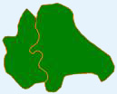
Split or Combine Tract/Stand
4
Create Island
4
Register Photo
It can be easily
learned by end-users.
|
|
|
|
|||||
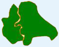
Shown is Combine Tract/Stand
|
||||||||
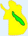
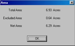
Shown is Acreage
Calculation
|
||||||||
|
|
||||||||||||||||||
|
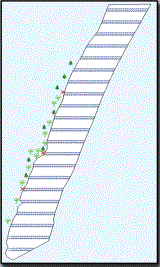
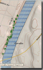
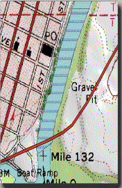
BASEMAPS |
|
|
|
|
||||||||||||||
|
High quality labeled BaseMaps are automatically
loaded with your differentially corrected job in the Map View. They contain useful vector data such as: |
||||||||||||||||||
|
· Roads · Railroads ·
Landmarks |
· Hydrology · Transportation ·
Key
Geographic Locations |
· City Limits ·
County
subdivisions ·
Blocks |
|
|||||||||||||||
|
|
|
|
|
|
||||||||||||||
|
|
|
|
|
|
||||||||||||||
|
BUFFERING: POINTS, LINES AND AREA BUFFERS |
||||||||||||||||||
|
·
Timber: Determining
no-cut zones along rivers (riparian areas) ·
Pipeline/DOT: Specifying road buffers for right-of-way ·
Parks: Park and recreation layout (green belt and creek buffers) ·
City/County: Housing development layout (quiet zones) · Municipal:
Specifying river flood
planes ·
Agriculture: Chemical
application and crop planning |
|
|
||||||||||||||||
|
|
|
|
|
|
||||||||||||||
|
|
|
|
|
|
||||||||||||||
|
Thousands of new point
symbols, line and area patterns have been added to the symbol library in
PC-GPS. |
||||||||||||||||||
|
Public |
Forestry |
Conservation |
Environment |
Survey |
Transportation |
|||||||||||||
|
|
|
|
|
|
|
|||||||||||||
|
Forestry Module (FM) for Farms [Lot/Crop vs. Tract/Stand
for Foresters] is built into PC-GPS, and the
low cost PC-GIS PRO (GIS software). |
||||||||||||||||||
|
|
|
|
|
|
||||||||||||||
|
**All trademarks are the property of their respective
owners. |
|
|
|
|||||||||||||||
|
|
|
|
|
|||||||||||||||
|
Download
a printable brochure here |
|
|
|
|||||||||||||||