|
|
|||||||
|
4
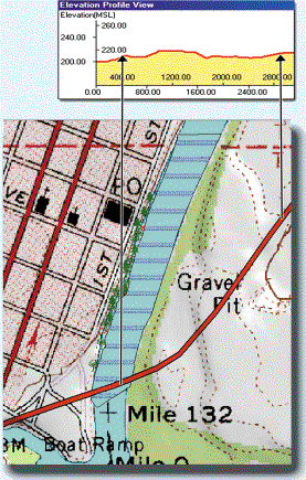
COGO (Coordinate Geometry) functions. 4 Create Contour Lines and Elevation Profiles using DEM (Digital Elevation Model) data. Drape shaded relief on your basemap.
4
Customize PC-GPS tool bars and menu items. 4 Launch Google Earth® and catpure an image from it.
4
Create a line or
area feature from Deed Call
text; or, create Deed Call text from an existing line or area feature.
4
Export
to, or import from, Microsoft® Excel
or Access.
4
Create
Buffers for points, lines and areas.
4
GeoJPEG,
Geotiff,
MRSID®,
JPEG2000, ECW
background image support.
4
Display Bearing
or Azimuth in the status bar when digitizing.
4
Use the Supplemental Database Management function to record time-based data for planning and historical data lookup.
|
|||||||
|
||||||||
Additional Functions: |
|
|||||||
4
Automatic BaseMap loading w/ preset colors, patterns and labels
4
Intelligent labeling for street names
4
Copy BaseMap elements into your map as features
4
Create Grid Points or Grid Lines on Timber Tracts and Stands.
4
Plot your maps, print to image files or save as PDF files
4
Adjust Transparency for
images and area features
4
Enhanced Display Photo and Multimedia functions Attach
photos, video or sound files to the features in your map.
4
USGS Quad Reference IDs
built-in
for easy selection of TOPO Maps
4
Map View with
Pan, Zoom to Topic and Zoom to Previous
4
Snap
to Feature, or
Include Line/Area Boundary while digitizing
4
Insert
Multiple Nodes while modifying
an existing Line or Area feature
4
Customize point & line digitizing shortcuts Name up
to 30 user-defined features with customized symbology to fit your specific
application. |
|
|||||||
|
||||||||
The Forester’s
Module (FM) for PC-GPS initiated by Georgia-Pacific
has become the most popular forest mapping software and is used by thousands
of foresters.
Georgia-Pacific had several choices on where
to turn for their project.
CMT was able to provide the powerful Forester’s
Toolkit such as:
4
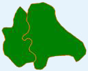
Split or Combine Tract/Stand
4
Create Island
4
Register Photo
It can be easily
learned by end-users. |
|
|
|
|||||
Shown is Combine Tract/Stand |
||||||||
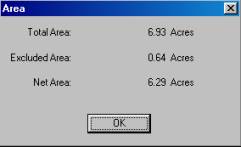
Shown is Acreage
Calculation |
||||||||


|
|
||||||||||||||||||
|
BASEMAPS |
|
|
|
|
||||||||||||||
|
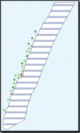
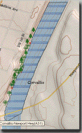
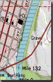
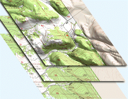
High quality labeled BaseMaps are automatically
loaded with your differentially corrected job in the Map View. They contain useful vector data such as: |
||||||||||||||||||
|
· Roads · Railroads ·
Landmarks |
· Hydrology · Transportation ·
Key
Geographic Locations |
· City Limits ·
County
subdivisions ·
Blocks |
|
|||||||||||||||
|
|
|
|
|
|
||||||||||||||
|
|
|
|
|
|
||||||||||||||
|
BUFFERING: POINTS, LINES AND AREA BUFFERS |
||||||||||||||||||
|
·
Timber: Determining
no-cut zones along rivers (riparian areas) ·
Pipeline/DOT: Specifying road buffers for right-of-way ·
Parks: Park and recreation layout (green belt and creek buffers) ·
City/County: Housing development layout (quiet zones) · Municipal:
Specifying river flood
planes ·
Agriculture: Chemical
application and crop planning |
|
|
||||||||||||||||
|
|
|
|
|
|
||||||||||||||
|
|
|
|
|
|
||||||||||||||
|
Thousands of new point
symbols, line and area patterns have been added to the symbol library in
PC-GPS. |
||||||||||||||||||
|
Public |
Forestry |
Conservation |
Environment |
Survey |
Transportation |
|||||||||||||
|
|
|
|
|
|
|
|||||||||||||
|
Forestry Module (FM) for Farms [Lot/Crop vs. Tract/Stand
for Foresters] is built into PC-GPS, and the
low cost PC-GIS PRO (GIS software). |
||||||||||||||||||
|
|
|
|
|
|
||||||||||||||
|
**All trademarks are the property of their respective
owners. |
|
|
|
|||||||||||||||
|
|
|
|
|
|||||||||||||||
|
Download
a printable brochure here |
|
|
|
|||||||||||||||